Pilatus
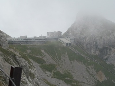
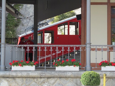
Sept 15, 2012Sometimes, you learn things the hard - and expensive - way. Like, for example, the weather forecast said partly cloudy. In the morning, it looked like fully cloudy, but our limited experience here has shown us that this is an early-in-the-morning phenomenon. So we decided to climb a mountain. When we got to the base, it really was partly cloudy - some nice sections of blue sky. So, we paid the almost $150 for the two of us to take the world's steepest cogwheel railway to the top of Mount Pilatus. When they say steep, they are not messing around: the grade ranges from 30% to 48%. Almost a 45-degree slope! It takes about half an hour to climb from about 400 m to about 2100 m. Interestingly enough, it took about 40 minutes to go back down on the same railway. They have a website, of course, where you can see the real story, even in English if you know where to click: http://www.pilatus.ch/. Anyway, back to the weather. It might have been partly cloudy down below, but at the top, it was fully cloudy! Some of the time, we could hardly see more than about 5 m away. So, there aren't very many pics, except for the odd occasion when the clouds cleared for a wee bit. But there are some! Most of these pictures were taken after we had wandered around the dual-hotel complex at the terminus of the railroad. We also had lunch there, another opportunity for us to enrich the Swiss economy. And yes, we knew that food up there would be expensive. Anyway, after lunch, we decided to hike a trail to the highest point there, called Tomlishorn, about 7000 feet. In the end, I wimped out when faced with some ugly stairs, but Stephen went on to the end. The hotel and train terminus complex at the top. There appears to be space for four trains.
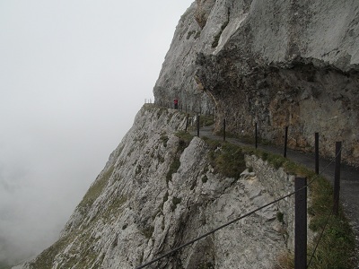
The trail to Tomlishorn. Notice the effort required to cut this trail out of the steep cliff. That's Stephen in the red jacket.
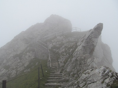
The stairs where I gave up on the trail.
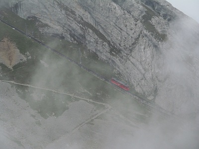
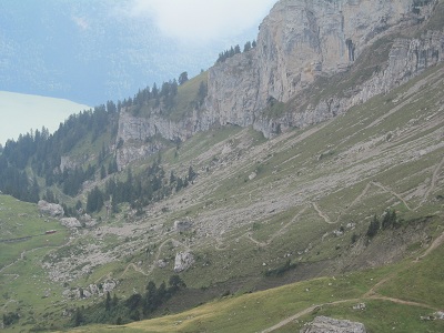
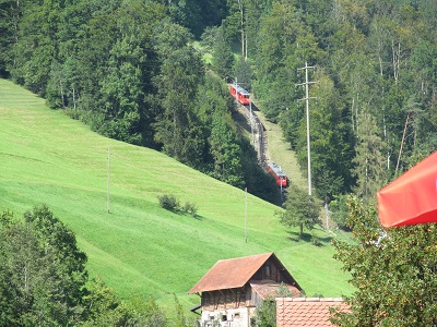
Another train on its way up. Notice the switchbacks for hikers and bikers. This is steep!
Gazing at some of the switchbacks in the valley below.
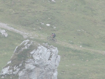
Here is a mountain biker below, climbing, climbing, climbing, probably about 90% of the way to the top.
And here is a somewhat jerky movie of some mountain bikers heading down. One rider appears to be, er, concerned! Their brakes have to be really really good!
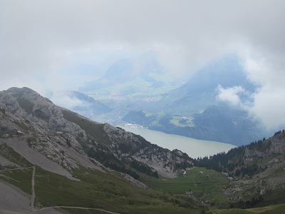
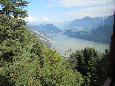
The clouds cleared up for a very short while, giving us a view of the lake below.
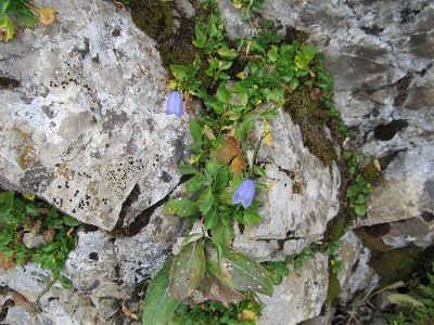
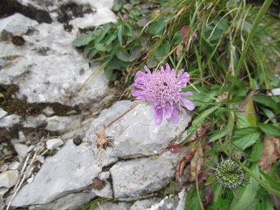
A blue flower and a pink flower.
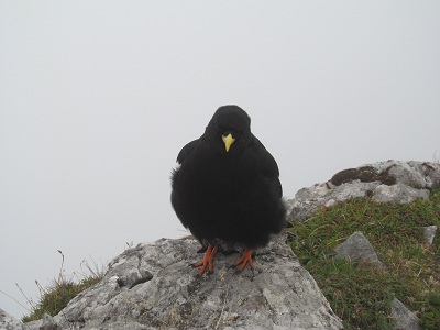
A bird, that may be called a chough - never heard of it, but it is definitely not a crow, although it looks like one from a distance.
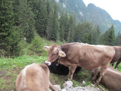
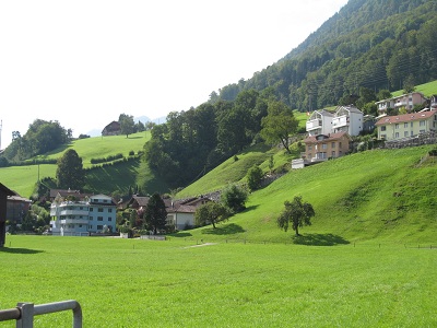
Stephen and I chuckle a lot about the Kananaskis cows that we see so often on our hikes there. These cows would definitely put the K-cows to shame! These were about half way up the mountain, right by the train tracks, grazing on those steep slopes. And clanging their bells!
On the way down, a view from the window of the train.
The lower terminus. This probably provides the best picture of the slope of the train.
Some views of the thriving metropolis of Alpnachstad, the lower terminus of the train.
This one shows the train track heading onward and upward.
And with some trains on it.
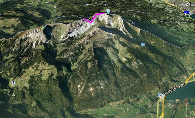
This is a Google Earth shot trying to give some perspective of what is going on. At the lower right, those symbols are at the lower terminus of the train. There is a little train symbol about half way up the mountain. And another one at the top, to the right of the pink line that shows my track for our hike. Remember, that top symbol is 1700 m above the bottom symbol.
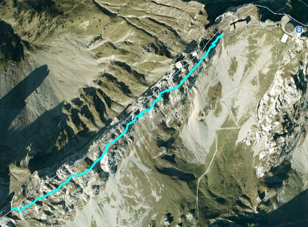
A from-above Google Earth view of my track.
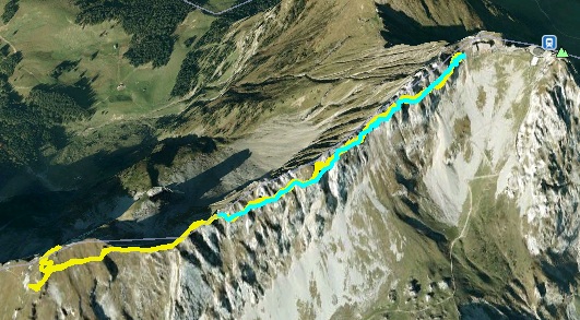
And another showing both my track and Stephen's - his is the longer one in yellow. I tried to get an angle so that you could see the steepness of the mountain. It might also demonstrate the steepness of the hiking/biking switchbacks.
Anyway, that was our adventure for today. Tomorrow, who knows?!?! |