Interlaken
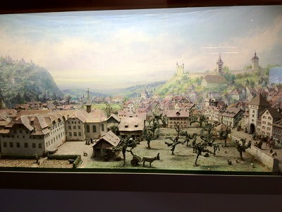
Sept 17, 2012Before getting into my story of today, here is a shot of an interesting diorama on display at the hotel, showing old Lucerne, with its wall in the background:
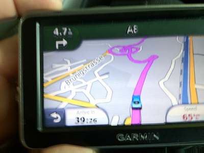
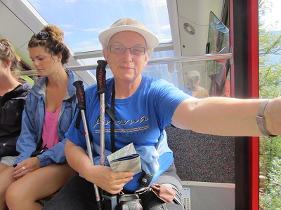
Now for the travelogue. Today, we decided to head for Interlaken, a lovely town with a gajillion hiking trails nearby. It's about 60 kms southwest of Lucerne, as the crow flies. We soon learned that it had to be a drunken crow... Now, you have to understand that one of the nifty things about Switzerland is the sheer volume of tunnels on the main roads. Switzerland has the highest cost per kilometer of road, due to all those tunnels. Some of the tunnels are incredibly long - like, one that we went through today was 5.2 kms. Think about it! It's like if there's a mountain in the way, bore a hole right through it. On the road from Lucerne to Interlaken, there was one point where we could tell that construction of yet another tunnel was underway. We didn't think about it too much, until all of a sudden we realized that we were on a relatively steep (i.e., low gear) climb up a really twisty and turny road. Finally, we reached a summit, and then headed down the other side on an equally twisty and turny road until we reached the valley where Interlaken is. "How twisty and turny?" you might ask. And I will reply with a couple of illustrations. I do have to admit that this photo of the navigator was taken on the return trip. On the outbound part, I was driving, and when I saw the navigator, my mind experienced a combination of terror and laughter. On the return trip, Stephen was driving, and I had my iPhone ready to take the picture at the appropriate moment. Enjoy!
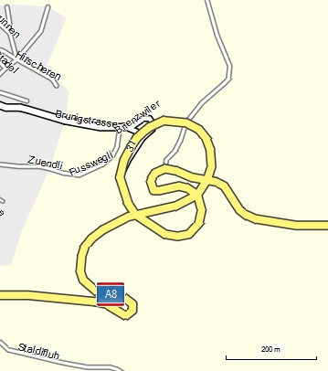
When we got back to the hotel, I checked my mapping software. Here's what it shows for the same spot:
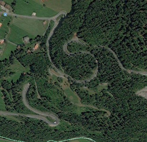
OK, here's the explanation. Starting from the right hand part of the map, you are heading downward. Do the tight switchback. Keep going round the bend, ever downward, until you come to a tunnel. Eventually, you come out of the tunnel, heading down the hill to where the blue A8 is. And after doing that switchback, you can breathe again. Here's the same section in Google Earth - it might make it easier to understand:
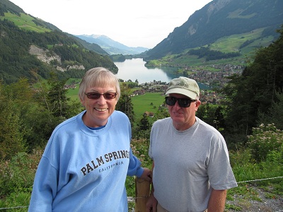
Going back a bit, partway up the first hill, we saw that there was a viewpoint coming up, so we pulled over. A group of young Malaysians were taking photos of each other, so I offered to get one of the whole group. They responded in kind. Here is the result. In the background is Samer See (Lake Samer).
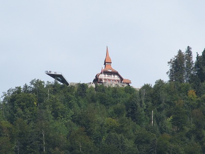
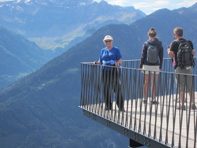
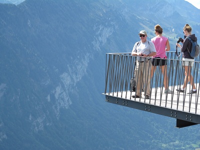
When we got back in the car, I said to myself, "Oops. We're on a hill. This is a car with a manual transmission. And the parking brake is just a button that you press when you are actually parked. It's not like gently releasing the parking brake while you gently put it into first gear. And that's a long way down!". But the car did not roll back at all. Whew!! (My first few cars were manual, so at least I had some experience with them.) So we finally reached Interlaken, found a parkade, and set out on our journey. We were really close to the tourist info place, so we picked up a few trail maps. One of the things that caught our eye immediately was this structure waaaaaaay up there, with the walkout observation deck.
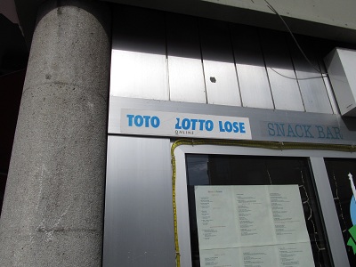
And Stephen says to me, "you'll never see me on that". More on that later! We decided to take a gentle stroll along the river walk. And saw some interesting things. Like this sign, which doesn't mean that lottery players are losers (even if they are, in general).
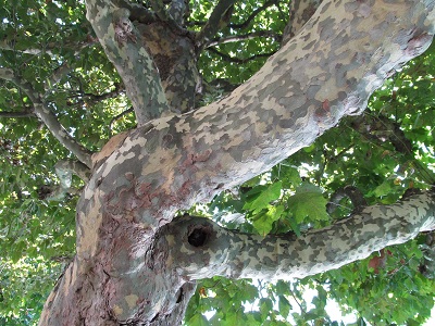
Or this variety of maple tree, with the camouflage bark.
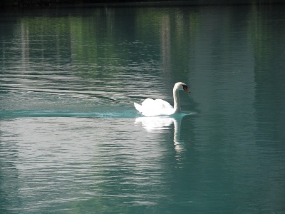
I love swans.
Anyway, we were quite enjoying the river walk, when Stephen pointed out that just over there was a Funicular railroad, one where the train is pulled up by cables. Shall we go up? Why not! So we did. This photo shows both my smiling happy face - and Stephen reflected in the glass.
This train is known as the Harderbahn, or Harder train. It climbs 755 m in 8 minutes. When we got to the top, we realized that we were exactly at the spot shown in the photo above, complete with the jutting out observation deck. So here are a couple of "we were there" photos.
From there, we could see Thuner See (or lake).
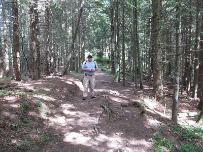
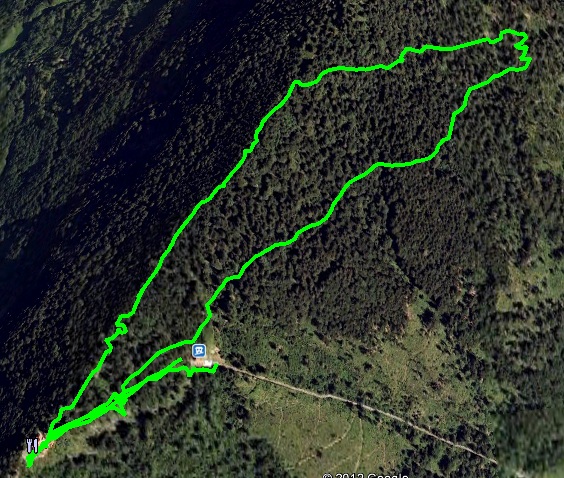
From the maps that we had acquired earlier, we knew there were trails up there, so of course, off we went, on something called the Rundweg Harder, or the Harder Loop. It was not easy! It started off with an elevation gain of around 150 m, followed by an elevation decline of about the same amount, before flattening out on the final bit. We probably walked around 3 kms in total. This photo shows Stephen on the rooty trail.
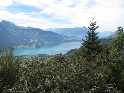
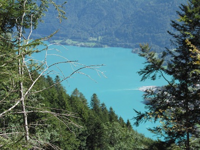
We didn't have a whole lot of good views on the trail - a lot of tall trees blocked our view. But there were a couple of spots where there was a break and we could see some of the scenery around us. Like this, of Brienzer See (or lake). Interlaken is between Thuner See and Brienzer See - hence the name, probably.
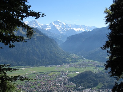
And this one, of Interlaken and Mount Jungfrau (called the Top of Europe in the trail map).
Here's the Google Earth view of the trail, slightly tilted to show the topography.
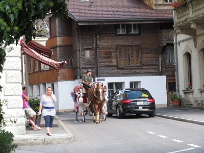
We came back down by funicular - no way were my knees going to manage a 755 m descent. And strolled back along the river path to the car, where we saw one more interesting sight - a horse-drawn carriage.
Then we headed back home, up and down the road that I never want to be on again, either as driver or passenger! We have not yet planned tomorrow's adventure. But Stephen is talking about a boat cruise on Lake Lucerne - that would definitely be easy on the knees. |